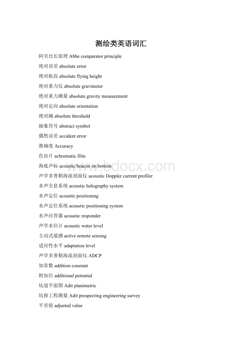
测绘类英语词汇文档格式.docx
《测绘类英语词汇文档格式.docx》由会员分享,可在线阅读,更多相关《测绘类英语词汇文档格式.docx(74页珍藏版)》请在冰豆网上搜索。

航摄软片aerialfilm
航空摄影测量aerialphotogrammetry
航摄像片,航空像片aerialphotograph
航摄漏洞aerialphotographicgap
航空摄影aerialphotography
航空遥感aerialremotesensing
航空摄谱仪aerialspectrograph
空中水准测量aeroleveling
航空图aeronauticalchart
空中导线测量aerophotogonometry
航空摄影测量aerophotogrammetry
空中三角测量aerotriangulation
变换光束测图affineplotting
仿射纠正affinerectification
拖底扫海agroundsweeping
摄影基线airbase
航空重力测量airbornegravitymeasurement
机载激光测探airbornelasersounding
机载遥感器airbornesensor
机场跑道测量airfieldrunwaysurvey
机场测量airportsurvey
定线测量Alignmentsurvey
测高仪Altimeter
高度角altitudeangle
分潮振幅amplitudeofpartialtide
互补色地图anaglyphicmap
互补色立体观察anaglyphicalstereoscopicviewing
互补色镜anaglyphoscope
模拟空中三角测量analogaerotriangulation
模拟地图analogmap
模拟法测图analogphotogrammetricplotting
模拟摄影测量analogphotogrammetry
模拟立体测图仪analogstereoplotter
模拟磁带analogtape
卫星共振分析analysisofsatelliteresonance
解析图根点analyticmappingcontrolpoint
解析空中三角测量*电算加密analyticalaerotriangulation
分析地图analyticalmap
解析测图analyticalmapping
解析定向analyticalorientation
解析摄影测量analyticalphotogrammetry
解析测图仪analyticalplotter
解析纠正analyticalrectification
运动方程分析解analyticalsolutionofmotionequation
锚地Anchorage
锚位anchorageberth
禁[止抛]锚区anchorage-prohibitedarea
古地图ancientmap
导线角度闭合差angleclosingerroroftraverse
像场角angularfieldofview
动画制图animatedmapping
动画引导animatedsteering
附合水准路线annexedlevelingline
调绘Annotation
磁变年差annualchangeofmagneticvariation
年平均海面annualmeansealevel
天线高度antennaheight
光圈,*有效孔径Aperture
视地平线apparenthorizon
实用地图学appliedcartography
近似平差approximateadjustment
任意轴子午线arbitraryaxismeridian
任意投影arbitraryprojection
任意比例尺arbitraryscale
考古摄影测量archaeologicalphotogrammetry
建筑摄影测量architecturalphotogrammetry
高斯投影方向改正arc-to-chordcorrectioninGaussprojection
面水准测量arealeveling
范围法areamethod
面状符号areasymbol
运动线法Arrowheadmethod
人工标志[点]artificialtarget
整体感associativeperception
假定坐标系assumedcoordinatesystem
深度基准面保证率assuringrateofdepthdatum
天文大地垂线偏差astro-geodeticdeflectionofthevertical
天文大地网astro-geodeticnetwork
天文重力水准astro-gravimetricleveling
等高仪astrolabe
天文年历astronomicalalmanac
天文方位角astronomicalazimuth
天文坐标测量仪astronomicalcoordinatemeasuringinstrument
天文年历astronomicalephemeris
天文纬度astronomicallatitude
天文水准astronomicalleveling
天文经度astronomicallongitude
天文点astronomicalpoint
天文定位系统astronomicalpositioningsystem
天文经纬仪astronomicaltheodolite
地图集信息系统Atlasinformationsystem
大地天顶延迟atmospherezenithdelay
大气改正,*气象改正atmosphericcorrection
大气阻力摄动atmosphericdragperturbation
大气噪声atmosphericnoise
大气透过率atmospherictransmissivity
大气窗atmosphericwindow
原子钟atomicclock
姿态Attitude
姿态参数attitudeparameter
姿态测量遥感器attitude-measuringsensor
属性精度attributeaccuracy
自准直目镜autocollimatingeyepiece
动感autokineticeffect
自动化地图制图automaticcartography
自动坐标展点仪automaticcoordinateplotter
水深测量自动化系统automatichydrographicsurveysystem
自动安平水准仪automaticlevel
自动绘图automaticplotting
自动空中三角测量automatictriangulation
平均误差averageerror
极坐标定位方法,*方位距离定位方法azimuthdistancepositioningmethod
像片方位角azimuthofphotograph
方位投影azimuthalprojection
弹道摄影机ballisticcamera
弹道摄影测量ballisticphotogrammetry
明礁barerock
基线baseline
基线测量baselinemeasurement
基线网baselinenetwork
地形底图basemapoftopography
岸台,*固定台basestation
基本重力点basicgravimetricpoint
基本比例尺basicscale
海底地形图bathymetricchart
海底地形测量bathymetricsurveying
贝叶斯分类Bayesianclassification
立标Beacon
波束角beamangle
水准点Benchmark
泊位Berth
贝塞尔椭球Besselellipsoid
贝塞尔大地主题解算公式Besselformulaforsolutionofgeodeticproblem
中心式快门between-the-lensshutter
二值图像binaryimage
生物量指标变换biomassindextransformation
生物医学摄影测量biomedicalphotogrammetry
鸟瞰图bird‘seyeviewmap
鸟瞰图bird'
seyeviewmap
布耶哈马问题Bjerhammarproblem
黑白片black-and-whitefilm
黑白摄影black-and-whitephotography
闪闭法立体观察blinkingmethodofstereoscopicviewing
区域网平差blockadjustment
块状图blockdiagram
蓝底图bluekey
地固坐标系body-fixedcoordinatesystem
钻孔位置测量bore-holepositionsurvey
底质bottomcharacteristics
底质调查bottomcharacteristicsexploration
底质采样bottomcharacteristicssampling
底质分布图bottomsedimentchart
布格异常Bougueranomaly
布格改正Bouguercorrection
界址点boundarymark
界址点boundarypoint
盒式分类法boxclassificationmethod
浪花Breaker
贯通测量breakthroughsurvey
防波堤Breakwater
桥梁轴线测设bridgeaxislocation
桥梁控制测量bridgeconstructioncontrolsurvey
桥梁测量bridgesurvey
模型连接bridgingofmodel
广播星历broadcastephemeris
布隆斯公式Brunsformula
水准器Bubble
建筑物沉降观测buildingaxissurvey
建筑工程测量buildingengineeringsurvey
光束法空中三角测量bundleaerialtriangulation
浮标Buoy
粗码C/ACode
机助地图制图CAC
地籍调查cadastralinventory
地籍册cadastrallists
地籍图cadastralmap
地籍制图cadastralmapping
地籍修测cadastralrevision
地籍测量cadastralsurvey
地籍管理cadastralsurveymanual
地籍cadastre
摄影机检校cameracaliberation
摄站camerastation
摄影经纬仪cameratransit
载波相位测量carrierphasemeasurement
分区统计图表法cartodiagrammethod
分区统计图表法,*等值区域法cartogrammethod
地图分析cartographicanalysis
地图分类cartographicclassification
地图传输cartographiccommunication
地图数据库cartographicdatabase
地图评价cartographicevaluation
制图夸大cartographicexaggeration
制图专家系统cartographicexpertsystem
制图分级cartographichierarchy
地图信息cartographicinformation
地图信息系统cartographicinformationsystem
地图语言cartographiclanguage
地图研究法cartographicmethodology
地图模型,*制图模型cartographicmodel
地图模型,cartographicmodel
地图内容结构cartographicorganization
地图潜信息cartographicpotentialinformation
地图语用cartographicpragmatics
地图表示法cartographicpresentation
地图选取cartographicselection
地图语义cartographicsemantics
地图符号学cartographicsemiology
制图简化cartographicsimplification
地图制图软件cartographicsoftware
地图语法cartographicsyntactics
地图学cartography
地图量算法cartometry
汇水面积测量catchmentareasurvey
电荷耦合器件CCD
计算机兼容磁带CCT
光碟,*光盘CD
天球坐标系celestialcoordinatesystem
格网单元cell
线路中线测量centerlinesurvey
对中杆centeringrod
点下对中centeringunderpoint
中央子午线centralmeridian
离心力centrifugalforce
中国大地测量星表CGSC
钱德勒摆动Chandlerwobble
航道channel
感光特性曲线characteristiccurveofphotographictransmission
灯[光性]质characteristicoflight
大气传输特性characteristicsofatmospherictransmission
电荷耦合器件charge-coupleddevice
海图Chart
海图图廓Chartboarder
海图编制Chartcompilation
海图改正Chartcorrection
海图大改正Chartlargecorrection
海图编号Chartnumbering
海洋重力异常图Chartofmarinegravityanomaly
海图投影Chartprojection
海图比例尺Chartscale
海图小改正Chartsmallcorrection
海图分幅Chartsubdivision
海图标题Charttitle
海图制图charting
监视台,*检测台Checkstation
中国大地测量星表ChineseGeodeticStarsCatalogue
中国测绘学会ChineseSocietyofGeodesy,PhotogrammetryandCartog
线性调频脉冲Chirp
弦线支距法Chordoff-setmethod
分区统计图表法chorisogrammethod
等值区域图,*分区量值地图choroplethicmap
分区统计图法,*等值区域法choroplethicmethod
国际协议原点CIO
度盘circle
圆曲线测设circularcurvelocation
地图信息系统CIS
克莱罗定理Clairauttheorem
分类器classifier
净空区测量clearancelimitsurvey
倾斜仪clinometer
剪辑clipping
时钟频率clockfrequency
钟偏clockoffset
钟速clockrate
闭合水准路线closedlevelingline
闭合导线closedtraverse
近景摄影测量close-rangephotogrammetry
闭合差closingerror
坐标增值闭合差closingerrorincoordinateincrement
闭合差closure
粗码Coare/AcquisionCode
海岸coast
海岸图coastchart
海岸线coastline
海岸地形测量coasttopographicsurvey
沿海测量coastwisesurvey
扇谐系数coefficientofsectorialharmonics
田谐系数coefficientoftesseralharmonics
带谐系数coefficientofzonalharmonics
认知制图cognitivemapping
视准线法collimationlinemethod
共线方程collinearityequation
地图色标colorchart
彩色编码colorcoding
彩色坐标系colorcoordinatesystem
彩色增强colorenhancement
彩色片colorfilm
彩色红外片,*假彩色片colorinfraredfilm
色彩管理系统colormanagementsystem
彩色样图colormanuscript
彩色摄影colorphotography
彩色校样colorproof
彩色复制colorreproduction
电子分色机colorscanner
彩色感光器材colorsensitivematerial
分色,*分色参考图colorseparation
颜色空间colorspace
彩色变换colortransformation
色环colorwheel
联合平差combinedadjustment
水位遥报仪communicationdeviceofwaterlevel
光碟,*光盘compactdisc
比较地图学comparativecartography
联测比对comparisonsurvey
邻图拼接比对comparisonwithadjacentchart
罗盘仪compass
罗经[校正]标compassadjustmentbeacon
方位圈compassrose
罗盘仪测量compasssurvey
罗盘经纬仪compasstheodolite
补偿器补偿误差compensatingerrorofcompensator
波浪补偿compensationofundulation
补偿器compensator
自动安平水准仪compensatorlevel
编绘compilation
编绘原图compiledoriginal
综合地图集comprehensiveatlas
综合地图comprehensivemap
计算机制图综合computercartographicgeneralization
计算机兼容磁带computercompatibletape