GPS 观测O文件头部分 rinex格式详细说明.docx
《GPS 观测O文件头部分 rinex格式详细说明.docx》由会员分享,可在线阅读,更多相关《GPS 观测O文件头部分 rinex格式详细说明.docx(21页珍藏版)》请在冰豆网上搜索。

GPS观测O文件头部分rinex格式详细说明
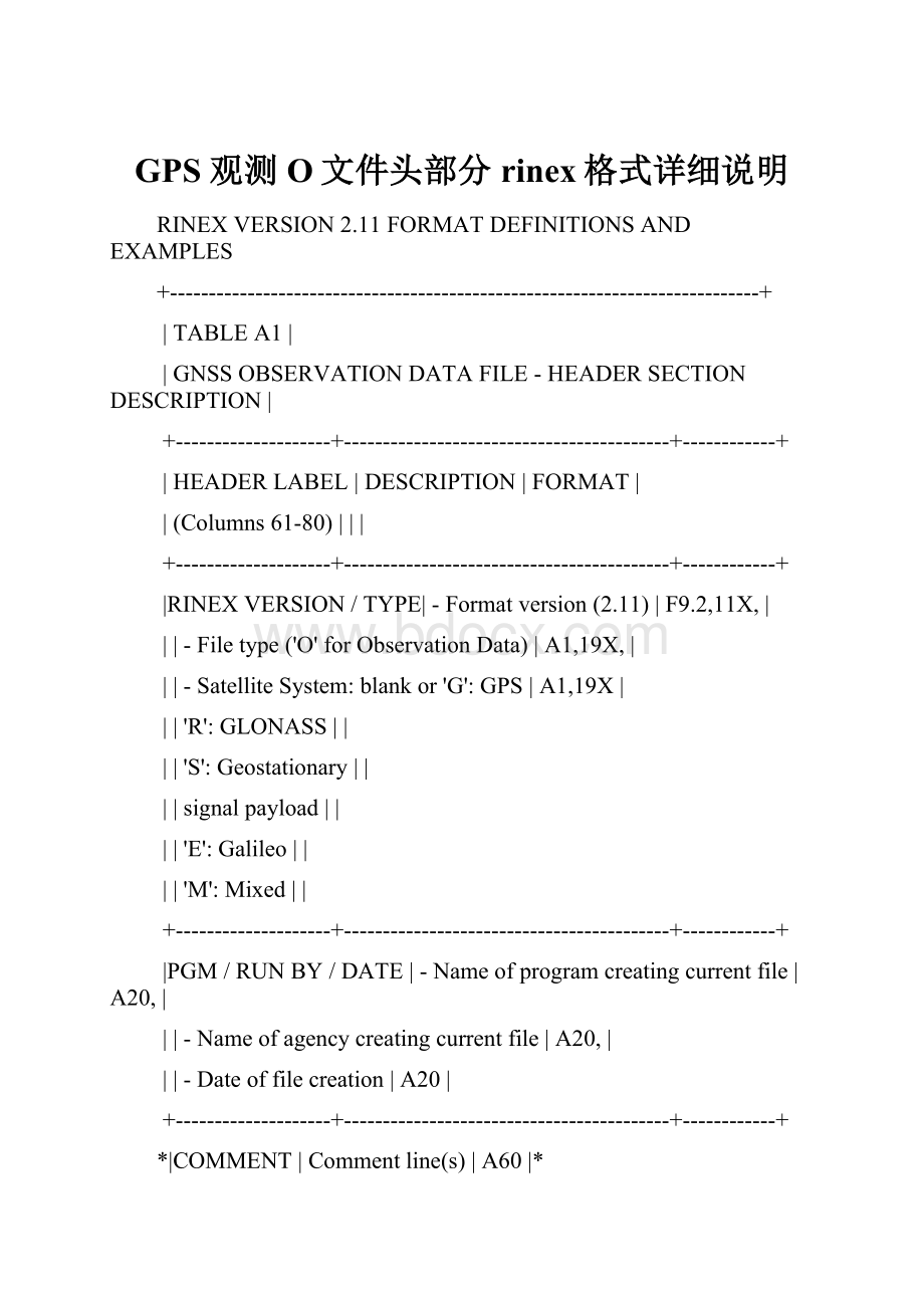
RINEXVERSION2.11FORMATDEFINITIONSANDEXAMPLES
+----------------------------------------------------------------------------+
|TABLEA1|
|GNSSOBSERVATIONDATAFILE-HEADERSECTIONDESCRIPTION|
+--------------------+------------------------------------------+------------+
|HEADERLABEL|DESCRIPTION|FORMAT|
|(Columns61-80)|||
+--------------------+------------------------------------------+------------+
|RINEXVERSION/TYPE|-Formatversion(2.11)|F9.2,11X,|
||-Filetype('O'forObservationData)|A1,19X,|
||-SatelliteSystem:
blankor'G':
GPS|A1,19X|
||'R':
GLONASS||
||'S':
Geostationary||
||signalpayload||
||'E':
Galileo||
||'M':
Mixed||
+--------------------+------------------------------------------+------------+
|PGM/RUNBY/DATE|-Nameofprogramcreatingcurrentfile|A20,|
||-Nameofagencycreatingcurrentfile|A20,|
||-Dateoffilecreation|A20|
+--------------------+------------------------------------------+------------+
*|COMMENT|Commentline(s)|A60|*
+--------------------+------------------------------------------+------------+
|MARKERNAME|Nameofantennamarker|A60|
+--------------------+------------------------------------------+------------+
*|MARKERNUMBER|Numberofantennamarker|A20|*
+--------------------+------------------------------------------+------------+
|OBSERVER/AGENCY|Nameofobserver/agency|A20,A40|
+--------------------+------------------------------------------+------------+
|REC#/TYPE/VERS|Receivernumber,type,andversion|3A20|
||(Version:
e.g.InternalSoftwareVersion)||
+--------------------+------------------------------------------+------------+
|ANT#/TYPE|Antennanumberandtype|2A20|
+--------------------+------------------------------------------+------------+
|APPROXPOSITIONXYZ|Approximatemarkerposition(WGS84)|3F14.4|
+--------------------+------------------------------------------+------------+
|ANTENNA:
DELTAH/E/N|-Antennaheight:
Heightofbottom|3F14.4|
||surfaceofantennaabovemarker||
||-Eccentricitiesofantennacenter||
||relativetomarkertotheeast||
||andnorth(allunitsinmeters)||
+--------------------+------------------------------------------+------------+
*|WAVELENGTHFACTL1/2|-Defaultwavelengthfactorsfor||*
||L1andL2(GPSonly)|2I6,|
||1:
Fullcycleambiguities||
||2:
Halfcycleambiguities(squaring)||
||0(inL2):
Singlefrequencyinstrument||
||-zeroorblank|I6|
||||
||Thewavelengthfactorrecordisoptional||
||forGPSandobsoleteforothersystems.||
||Wavelengthfactorsdefaultto1.||
||Iftherecordexistsitmustprecedeany||
||satellite-specificrecords(seebelow).||
+--------------------+------------------------------------------+------------+
*|WAVELENGTHFACTL1/2|-WavelengthfactorsforL1andL2(GPS)|2I6,|*
||1:
Fullcycleambiguities||
||2:
Halfcycleambiguities(squaring)||
||0(inL2):
Singlefrequencyinstrument||
||-Numberofsatellitestofollowinlist|I6,|
||forwhichthesefactorsarevalid.||
||-ListofPRNs(satellitenumberswith|7(3X,A1,I2)|
||systemidentifier)||
||||
||Theseoptionalsatellitespecificlines||
||mayfollow,iftheyidentifyastate||
||differentfromthedefaultvalues.||
||||
||Repeatrecordifnecessary.||
+--------------------+------------------------------------------+------------+
|#/TYPESOFOBSERV|-Numberofdifferentobservationtypes|I6,|
||storedinthefile||
||-Observationtypes||
||-Observationcode|9(4X,A1,|
||-Frequencycode|A1)|
||Ifmorethan9observationtypes:
||
||Usecontinuationline(s)(including|6X,9(4X,2A1)|
||theheaderlabelincols.61-80!
)||
||||
||Thefollowingobservationtypesare||
||definedinRINEXVersion2.11:
||
||||
||Observationcode(useuppercaseonly):
||
||C:
PseudorangeGPS:
C/A,L2C||
||Glonass:
C/A||
||Galileo:
All||
||P:
PseudorangeGPSandGlonass:
Pcode||
||L:
Carrierphase||
||D:
Dopplerfrequency||
||S:
RawsignalstrengthsorSNRvalues||
||asgivenbythereceiverforthe||
||respectivephaseobservations||
||||
||Frequencycode||
||GPSGlonassGalileoSBAS||
||1:
L1G1E2-L1-E1L1||
||2:
L2G2----||
||5:
L5--E5aL5||
||6:
----E6--||
||7:
----E5b--||
||8:
----E5a+b--||
||||
||ObservationscollectedunderAntispoofing||
||areconvertedto"L2"or"P2"andflagged||
||withbit2oflossoflockindicator||
||(seeTableA2).||
||||
||Units:
Phase:
fullcycles||
||Pseudorange:
meters||
||Doppler:
Hz||
||SNRetc:
receiver-dependent||
||||
||Thesequenceofthetypesinthisrecord||
||hastocorrespondtothesequenceofthe||
||observationsintheobservationrecords||
+--------------------+------------------------------------------+------------+
*|INTERVAL|Observationintervalinseconds|F10.3|*
+--------------------+------------------------------------------+------------+
|TIMEOFFIRSTOBS|-Timeoffirstobservationrecord|5I6,F13.7,|
||(4-digit-year,month,day,hour,min,sec)||
||-Timesystem:
GPS(=GPStimesystem)|5X,A3|
||GLO(=UTCtimesystem)||
||GAL(=GalileoSystemTime)||
||CompulsoryinmixedGPS/GLONASSfiles||
||Defaults:
GPSforpureGPSfiles||
||GLOforpureGLONASSfiles||
||GALforpureGalileofiles||
+--------------------+------------------------------------------+------------+
*|TIMEOFLASTOBS|-Timeoflastobservationrecord|5I6,F13.7,|*
||(4-digit-year,month,day,hour,min,sec)||
||-Timesystem:
Samevalueasin|5X,A3|
||TIMEOFFIRSTOBSrecord||
+--------------------+------------------------------------------+------------+
*|RCVCLOCKOFFSAPPL|Epoch,code,andphasearecorrectedby|I6|*
||applyingtherealtime-derivedreceiver||
||clockoffset:
1=yes,0=no;default:
0=no||
||Recordrequiredifclockoffsetsare||
||reportedintheEPOCH/SATrecords||
+--------------------+------------------------------------------+------------+
*|LEAPSECONDS|Numberofleapsecondssince6-Jan-1980|I6|*
||Recommendedformixedfiles||
+--------------------+------------------------------------------+------------+
*|#OFSATELLITES|Numberofsatellites,forwhich|I6|*
||observationsarestoredinthefile||
+--------------------+------------------------------------------+------------+
*|PRN/#OFOBS|PRN(sat.number),numberofobservations|3X,A1,I2,9I6|*
||foreachobservationtypeindicated||
||inthe"#/TYPESOFOBSERV"-record.||
||||
||Ifmorethan9observationtypes:
||
||Usecontinuationline(s)including|6X,9I6|
||theheaderlabelincols.61-80!
||
||||
||Thisrecordis(theserecordsare)||
||repeatedforeachsatellitepresentin||
||thedatafile||
+--------------------+------------------------------------------+------------+
|ENDOFHEADER|Lastrecordintheheadersection.|60X|
http:
//igscb.jpl.nasa.gov/igscb/data/format/rinex211.txt
+--------------------+------------------------------------------+------------+
GPRRinex文件之o文件说明
标签:
GPR Rinex o 说明 分类:
我的测绘2009-02-0919:
45
2.10 OBSERVATIONDATA G(GPS) RINEXVERSION/TYPE RINEX版本/观测数据类型
DAT2RINW3.10001 WuXuepeng 01APR06 9:
47:
37 PGM/RUNBY/DATE 项目/执行者/日期
WuXuepeng GCEDD OBSERVER/AGENCY 观测者/公司
20253469 TRIMBLE4600LS Nav2.50Sig0.11 REC#/TYPE/VERS 接收机编号/接收机类型/接收机版本
20253469 4600LSINTERNAL ANT#/TYPE 天线编号/天线类型
-----------------------------------------------------------COMMENT 注释
OffsetfromBOTTOMOFANTENNAtoPHASECENTERis107.0mm COMMENT 补偿从天线底部到相位中心107.0毫米 注释
-----------------------------------------------------------COMMENT 注释
I1234 MARKERNAME 标识点名称
I1234 MARKERNUMBER 标识点数量
-2666295.7398 4700154.0487 3376886.4779 APPROXPOSITIONXYZ 标识点概略坐标XYZ(WGS-84)
1.4065 0.0000 0.0000 ANTENNA:
DELTAH/E/N 改正到相位中心的天线高度H高程/E东坐标/N北坐标
***AboveantennaheightisfrommarktoPHASECENTER. COMMENT 上面的天线高是从测量标志到天线相位中心 注释
-----------------------------------------------------------COMMENT 注释
Note:
Theaboveheightistotheantennaphasecenter. COMMENT 注释:
上面的天线高是到天线相位中心 注释
TheRINEXspecificationcallsforthistobethe COMMENT RINEX规格要求 注释
heightfromthebottomsurfaceoftheantennamount COMMENT 天线高是从天线座底部 注释
tothesurveymark. COMMENT 到测量标志。
注释
Note:
TheaboveoffsetsareCORRECTED. COMMENT 注释:
上面的补偿是改正后的。
注释
RawOffsets:
H= 1.3450E= 0.0000N= 0.0000 COMMENT 原始补偿:
H=1.3450(原始天线高)E=0.0000N=0.0000 注释
-----------------------------------------------------------COMMENT 注释
1 0